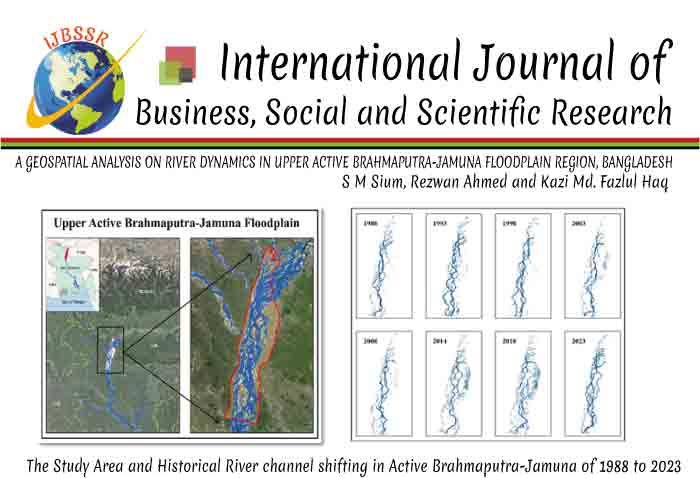
A GEOSPATIAL ANALYSIS ON RIVER DYNAMICS IN UPPER ACTIVE BRAHMAPUTRA-JAMUNA FLOODPLAIN REGION, BANGLADESH

DOI:
http://doi.org/10.55706/ijbssr11204
The
hydro-geomorphic dynamism of the Brahmaputra-Jamuna River system in Bangladesh
poses critical challenges for sustainable river management, given the country's
vulnerability to climate change and riverbank erosion. The present study
employs a longitudinal analysis of Landsat and Sentinel images from 1988 to
2023, integrated with Remote Sensing (RS) and Geographic Information Systems
(GIS), to provide a temporal assessment of the river’s dynamic behavior.
Results reveal significant temporal and seasonal fluctuations in the riverbed's
spatial extent, dynamism rate, and common area, underlining the system's
inherent volatility. Between 1988 and 2023, the riverbed’s area exhibited
marked variability, ranging from 237.9537 km² to 365.8552 km². Seasonal evaluations
also pinpointed pronounced changes, particularly in pre-monsoon and monsoon
periods, revealing substantial variations in dynamism area and rates. The study
uncovers intriguing patterns, such as the anomalous high dynamism area in 2020
and the surge in winter dynamism rate in 2022, calling for a deeper inquiry
into potential climatic anomalies or anthropogenic influences and the need for
ongoing monitoring and adaptive river management, particularly under increased
environmental stress from climate change.

